Na poczatek w dziale Historia pragn¹³bym umieœcic kilka map.
Pierwsza z nich pochodzi z roku 1812 jest fragmentem mapy niemiec zrobionej dla ksiêcia Cambridge.
Tekst z legendy mapy.
A. Arrowsmith. London Published 2nd Oct. 1812

Ca³¹ mape mo¿na znaleŸæ na stronie http://www.posselt-landkarten.de, a dok³adnie to TU
Druga to mapa z 1895 roku i jest jednym z arkuszy mapy imperium niemieckiego - UWAGA mapa zajmuje 2,9 MB!

Ca³¹ mape mo¿na znaleŸæ na stronie http://www.posselt-landkarten.de, a dok³adnie to TU
Trzeci¹ mapa jest z 1874 roku i jest to arkusz o skali 1: 25 000
UWAGA mapa zajmuje 2,8 MB!
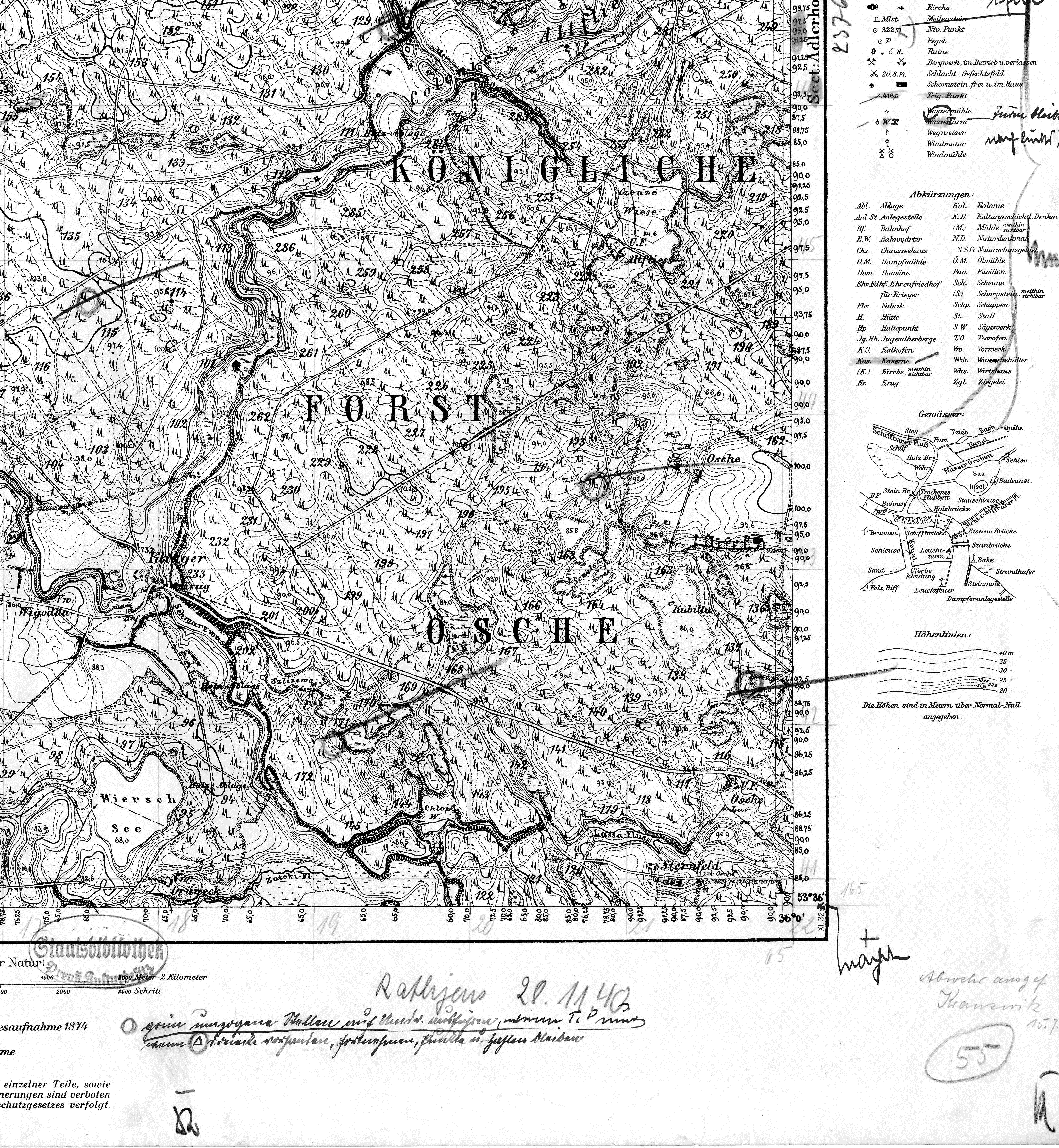
Mapa pochodzi z archiwum Biblioteki Pañstwowej w Berlinie – Fundacja Pruskiego Dziedzictwa Kulturalnegojest to jeden z materia³ów do mojej pracy magisterskiej.
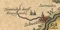
Kolejna mapa jest jednym z arkuszy atlasu z roku 1645 roku i pochodzi ze strony http://www.library.ucla.edu/yrl/reference/maps/blaeu/
UWAGA mapa zajmuje 4,5 MB!

Description of the Blaeu Atlas
This Latin edition of Willem Janszoon and Joan Blaeu's Theatrum orbis terrarum, sive, Atlas novus was published in 4 volumes beginning in 1645. The first edition of this atlas was published in 1635 as a two volume set in German, Dutch, Latin, and French. By 1662 the atlas had grown to 11 or 12 volumes depending on the edition and the inclusion of a sea-atlas. At this point in time the atlas became known as the Atlas maior. This work is considered the Blaeus' crowning achievement in the field of cartography.
YRL Reference and Instructional Services owns the first volume of the set,"Europa -Germania-Germania Inferior". The volume was given to the UCLA Center for Medieval and Renaissance Studies as part of a donation from the Margaret W. Romani Estate, and the Center offered the Atlas to the UCLA Library. The atlas contains extensive text, but only the map pages were scanned for this project. Scanning was funded by the Henry J. Bruman Educational Foundation.
This copy of the atlas lacks the following maps (based on the Table of Contents): Orbis Terrarum. Europa. Norvegia descriptio. Lithuania Magnus ducatus. Borysthenes fluvius. Hassia Landgraviatus. Francofurtense territorium. Danubius, & in illum defluentes fluvii. Dunkercka. Geldria ducatus. Hollandia comitatus. Zeelandia comitatus. Frisia Occidentalis.
Przy okazji tej may prosi³ bym o pomoc w próbie rozszyfrowania pewnej miejscowoœci pokazanej na wycinku poni¿ej - aby nie by³o w¹tpliwoœci - ten "strumyk" to Wda.